


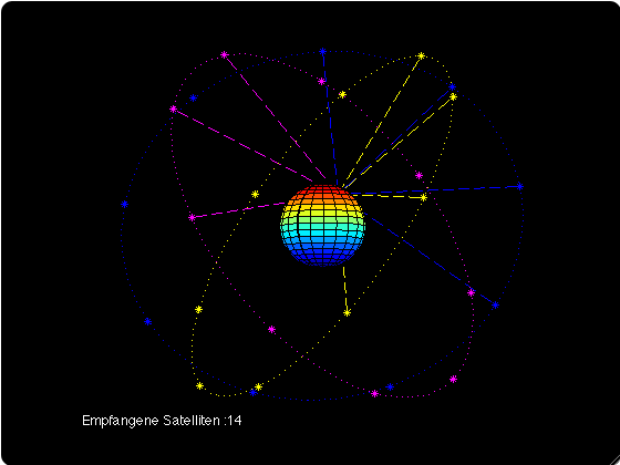
The Global satellite navigation system (GNSS) or GPS has almost become a term for the other. GPS is the oldest navigation system, which is one reason for this. The US Defense Department started it in 1978. Other navigation systems, such as GLONASS, Galileo, BeiDou, Quasi-Zenith, and India’s new NavIC, are also out there. This article looks at all of these options for GPS in great depth and compares them point by point. We’ve discussed what makes a satellite navigation system unique, such as its coverage, accuracy, orbital height, etc. Let’s get right to the list of GPS options.
5 GPS sites you should know about
1. GLONASS
If there is one satellite navigation system that is almost as good as GPS in accuracy and coverage, it is GLONASS. It has been used since 1995 and is developed and managed by Russia. The GLONASS constellation has 24 satellites, while the GPS constellation has 31. To make a world navigation satellite system work, you need more than 20 satellites. Since 2010, Russia has been taking care of the constellation.

Besides that, GLONASS and GPS orbit at almost the same height and for about the same amount of time, so they are the same in some ways. Regarding accuracy, GLONASS can find your location within 5 to 10 meters, which is great and very similar to GPS’s 4 to 7 meters range. We can be much more sure of where we are with the help of local cellphone tracking. GLONASS is a good Russian satellite navigation system; it’s only second to GPS regarding how well it works.
While NavIC is still pretty new regarding satellite navigation systems, it looks very good. If you don’t know, NavIC is an Indian-made satellite navigation system made for its own country and neighbors. We wrote a different article with more information about NavIC and why it’s better than GPS. You can read that article to get a better idea. NavIC is a regional navigation satellite system, while GPS is a worldwide navigation satellite system.

GPS can find your address anywhere worldwide, while NavIC is mostly used in India and some nearby areas. However, because the NavIC satellites are always in direct line of sight with India’s region, NavIC is comparatively better than GPS in accuracy, at least in India. To sum up, NavIC is an Indian satellite navigation system that works independently and looks like a better option than GPS. Also, it’s great that India plans to send at least five more satellites in the next few years.
3. Quasi-Zenith
Japan made the Quasi-Zenith Satellite System (QZSS), a regional satellite navigation method similar to India’s NavIC. Five satellites make up the QZSS constellation. In Japanese, it is also known as Michibiki. Japan started the project in 2010 and made the service available to everyone in 2018. Like GPS, the goal of Quasi-Zenith is to provide very accurate and stable positioning services in Japan and some other parts of the Asia-Oceania region. Their satellite navigation system has been developing slowly in Japan, but they plan to send seven more satellites by 2023.

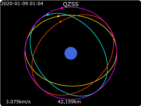
Like NavIC, QZSS adheres to Japan’s coordinates and follows the same rule of “direct line of sight at all times.” To ensure that at least one of its satellites can always be seen over Japan, it has put them in geostationary and geosynchronous orbit. In conclusion, Japan’s QZSS is not even close to being as good as the US’s GPS. However, it shows much promise, and we hope it will soon grow even more.
4. BeiDou
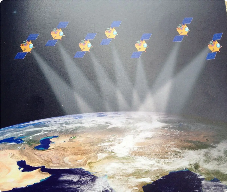
BeiDou is a world navigation satellite system run by China similar to GPS. To develop a GPS option for its users, the project was first started in 2000. Since there were only two satellites, the coverage was poor, and the accuracy was off. So, between 2012 and 2015, China sent 10 and 15 satellites into orbit around the Earth, making the constellation much bigger.

And since 2015, China has sent seven more satellites, bringing the total number of working satellites in the constellation to 33. So, regarding coverage, BeiDou and US GPS are nearly neck and neck. Aside from that, the accuracy is said to be 3–5 meters, which is great. It can also give you an exact spot within 10 cm, but only for military use. I can only say that BeiDou is just as good as GPS and could be used instead of GPS.
5. Galileo
The European Union chose to develop its satellite navigation system because most big countries already had one. The Galileo constellation went live in 2016, after they started the development in 2005. I want to clarify that Galileo is a world navigation satellite system, the same kind that GPS and GLONASS are. Currently, 22 working satellites are in the constellation orbiting around the Earth. The EU also wants to get 30 satellites in orbit by the end of this year.

GPS and Galileo are almost on the same plane regarding how they work, but Galileo is a little higher up. So, there you have it. Galileo has had problems with atomic clocks and weak messages in the past few years. In summary, Galileo is another global navigation satellite system that will improve after it hits Full Operational Capability (FOC) in 2020. It will then be a good option for GPS.
The 5 Best GPS Alternative Systems
These are the five options for GPS that Russia, China, India, the EU, and Japan have worked to develop. As I already said, only a few countries have put money into building their satellite navigation systems. This is mostly so they can be self-sufficient during air attacks, underwater attacks, and land wars. One more thing to remember is that users can’t pick which GNSS system to use. It depends on the tools and navigation apps they have on their phone. Remember that. That’s all from us. Please tell us what you think about this in the comments section below.